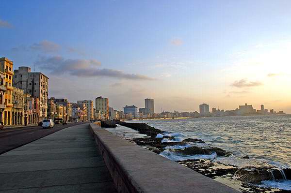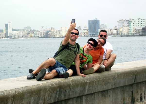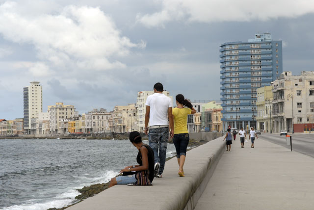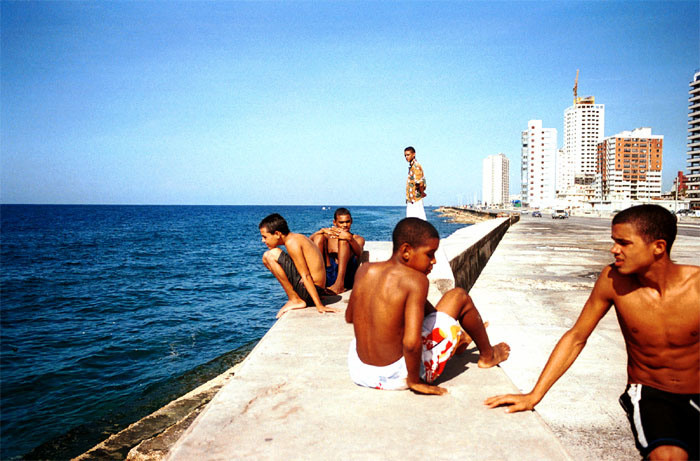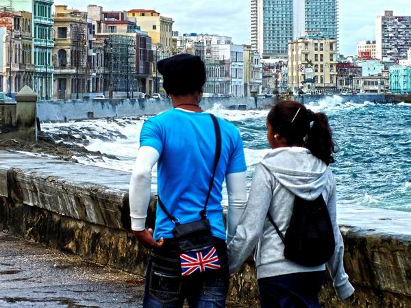
The mark of the distinctive character of this age-old and charismatic city both for Cubans and for foreigners. and one of the loveliest experiences when dusk begins to fall is taking a stroll along Havana’s Malecón, its seaside promenade. There you can find all sorts of people “armed” with their music, their rum, their beer, and when the gentle breeze of the trade winds allows, it becomes one of the jam-packed armchairs of the beautiful city of Havana. This is one of the best ways to meet Cubans, since they are talkative, open and witty; you can start up a conversation right away, and the hours will pass before you know it.
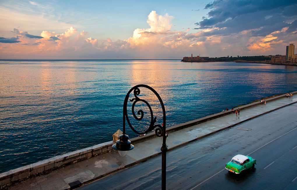
Millions of photos of this protective wall, Havana’s esplanade, with its colonial buildings with their indescribable charm, are in circulation in the world, and you won’t be able to resist its architectural and emotional attraction.
A little bit of history to help you appreciate the value of its engineering. For many years it was a rocky reef, but in 1859 the railway began to pass through all of San Lázaro, and it was decided to commission the plan for a complex public work that would go beyond a simple esplanade to the great Cuban engineer of the epoch. Mr. Francisco de Albear who created a complex design that we can read about in documents from long ago: “the wide avenue must be constructed at 4 meters above sea level, separated from the shore with a long succession of 250 arches to provide for the city’s needs, ” but the project would cost 850, 000 pesos in the currency of the time, and for a while it was abandoned. In 1901 tentative work would begin on the Malecón, at first called Avenida del Golfo, and after passing through different phases of advance and retreat, or being constructed one part at a time, the final pathway of a total of 7 kms up to Río Almendares, would be developed between the years 1950 and 1958 under the baton of the great city-planner Jean Forestier, who was stunned by the charm of the capital’s coastal zone.
Take a stroll through the area, share something with the people and you will quickly feel yourself engaged in the most authentic Cuban experience!…
For those of us who love this city, it holds places that are so charming that in the end they forgive us any infidelity. Because in the summer evenings Havana’s Malecón protects with its trade winds, this gentle breeze from the sea, immortalized by Tito Gómez; and when there are cold fronts or storms, it also sure to defend you from the raging sea. And all this so that afterwards you can abandon it for another spot in the city as soon as you have a chance…
And it has been that way since the cornerstone was laid at the beginning of the 20th century, when the Malecón only included the stretch that goes from Prado to Calle Crespo, with trees and street lights. But in the end nature itself imposes its own plan: a long barren wall, of “stripped” concrete, which guards a wide avenue besieged by the breaking waves of the Gulf Stream.
By the way, do you know what was the original name of the Malecón? Quite simple: “Avenida del Golfo.” The history of the Malecón began in 1819, when the so-called “expansion of the area outside the walls” was put into practice, since the city was growing, and the coastal area that went from the entry to the bay to the Torreón de San Lázaro, was only an open space of rock and sea, beautiful, but without any other claim than the inhospitality of the place to which a few families would go to bathe in the sea.
From Havana’s shore zone where today you will find Maceo park down to Almendares River, what existed then was a coast of jagged corral reefs and strong, impenetrable wilderness, which Spanish authorities had always considered a natural barrier against attacks and which they called “Monte Vedado, ” “The Forbidden Wilderness.”
It remained this way for many years, but in 1859 the urban railways began to circulate throughout San Lázaro from the port region to the mouth of the Almendares River. In this epoch, the neighborhoods of El Carmelo and Vedado sprang up.
Then they considered Havana’s inhospitable shoreline and commissioned Mr. Francisco de Albear, Cuba’s most important engineer in that era, with the project. Albear came up with a complex and appropriate formula for what the project should be beyond a simple promenade.
According to historical documents, the broad avenue was supposed to be built four meters above sea level, separated from the shore, and its lower part a long succession of 250 arches, to serve the city’s other needs, because the resulting gallery could serve as a railway line and storage space, intended for the active port of Havana or as a defensive military line.
The whole project would cost 850, 000 pesos in the currency of the time, but the Spanish government did not indulge Havana’s city administration, and Albear’s proposal went unrealized for a long time…
During the first North American intervention some projects were reinitiated, and the first segment was finished, from Prado to Crespo. This was the start of long and slow process to achieve the Malecón that we know today. In 1901, the first tentative work was done on the Malecón after adopting some regulations that included the prices of terrain, the ownership of properties, rights to confiscations and other provisions of this sort.
During Gerardo Machado’s presidency, his ambition to erect monuments brought new energy to the Malecón under the direction of the eminent city-planner Jean Forestier, famous for his interventions in Seville and Paris, who had come to Cuba to set up a Master Plan for the city.
Forestier was captivated by the capital’s coastal region, and he adopted the Malecón as the main concern of his projects. In order to achieve the seven kilometers that it measures today, the project went through various stages of advances and retreats, ruling governments, alterations, repressions and transformation of projects, until the last segment was completed between 1950 and 1958.
After the first segment, which made necessary the demolition of some public facilities such as the beach resorts, Las Delicias, Romanguera and San Rafael, construction continued until 1921 up to the entryway to Vedado, where the monument to the Maine currently stands.
By the middle of the decade of the 1930’s, it went up to calle G, and during the presidency of Carlos Prío (1948-1952), the Malecón reached the mouth of the Almendares River.
Each and every one of these continuations implied changes in the fabulous plans, which in the end became this long wall so beloved of the residents in this city, which a witty person once defined as “the world’s longest bench.”